GRASS GIS 7.0.0
GRASS GIS 7.0.0
We are pleased to announce the new stable release of GRASS GIS 7.0.0
What’s new in a nutshell
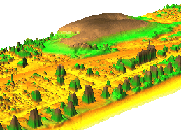
After many years of development the new stable major release GRASS GIS 7.0.0 is available. The graphical user interface based on wxPython has been enriched with many new features in order to make complex GIS operations available as simple as possible. The old Tcl/Tk based GUI has been dropped. The developers added important new functionality to the core system, among that the new Python interface to the C library. This new API permits users to create new GRASS GIS-Python modules in a simple way while yet obtaining powerful and fast modules. Furthermore, the vector library was significantly improved to make it faster and more efficient, along with support of huge files. This required a easy to manage topology format update including a new spatial index. A lot of effort has been invested to standardize parameter and flag names. Finally, there are a series of new modules to analyse raster and vector data; some of the already existing modules were improved and made faster (some even 1000 x faster). For details see below.
GRASS GIS 7.0.0 ships 10,500 fixes and improvements with respect to GRASS GIS 6.4.0 after more than six years of development. As a stable release 7.0 will enjoy long-term support.
GRASS GIS 7.0.0 also offers significantly improved performance for many raster and vector modules: "Many processes that would take hours now take less than a minute, even on my small laptop!" explains Markus Neteler, the coordinator of the development team composed of academics and GIS professionals from around the world.
Source code download:
- https://grass.osgeo.org/grass70/source/
- https://grass.osgeo.org/grass70/source/grass-7.0.0.tar.gz
- To get the GRASS GIS 7.0.0 source code directly from SVN, see here.
Binaries download:
- ... further binary packages for other Linux distributions will follow shortly.
More details:
Display system and graphical user interface: New portable display
system, used in the graphical user interface but as usual also with
command line support. Histogram support in legends added and much more.
The existing graphical user interface has been significantly improved
and extended with new functionality not easily found in other GIS.
Image Processing: Many new modules for creation of albedo,
emissivity and vegetation index maps, TOA calibration, biomass growth
and evapotranspiration estimation, image classification, hierarchical
image segmentation, pansharpening, cloud detection in LANDSAT data,
MODIS QA bitpattern management, graphical tool for Ground Control Points
for geocoding imagery, Tasseled-Cap transform support for Landsat 8 and
MODIS.
Raster support: Direct output to standard GIS raster formats
implemented, new LAS LiDAR point binning using univariate statistics,
support for WMS and WMTS, new multiple linear regression from raster
maps (results conformant with R), resampling using an analytic kernel,
and much more. Speed gain for viewsheds, cost surfaces, raster import,
geomorphometry, watershed calculation.
Vector support: The topology engine has been improved in speed and
precision. LAS LiDAR point clouds support added, new PostGIS 2
interface, various vector networking improvements, notable speed
improvements for vector import, generalization, kernel density
calculation, intersection, vector grid and hexagon calculation,
automated line vertex densification in reprojection for error
minimization, optionally constraining of random points to selected
polygons, vector area skeletonizer added and much more.
3D raster support: New modules for 3D raster color table
management, cleanup of the caching system.
New Temporal GIS support: A new temporal GRASS GIS 7 framework has
been developed to manage, process and analyse (big) spatio-temporal
environmental data. It supports querying, map calculation, aggregation,
statistics and gap filling for raster, vector and 3D raster data. A
temporal topology builder is available to build spatio-temporal topology
connections between map objects for 1D, 3D and 4D extents.
Bash and Python Scripts: All Bash scripts known from GRASS GIS 6
have been converted to Python for portability and speed reasons. Users
may obviously continue to run their shell scripts as before. Furthermore
a completely new Python interface has been developed.
See also our detailed announcement:
http://trac.osgeo.org/grass/wiki/Release/7.0.0-News
http://trac.osgeo.org/grass/wiki/Grass7/NewFeatures
First time users may explore the first steps
tutorial after
installation.
About GRASS GIS
The Geographic Resources Analysis Support System (https://grass.osgeo.org), commonly referred to as GRASS GIS, is an Open Source Geographic Information System providing powerful raster, vector and geospatial processing capabilities in a single integrated software suite. GRASS GIS includes tools for spatial modeling, visualization of raster and vector data, management and analysis of geospatial data, and the processing of satellite and aerial imagery. It also provides the capability to produce sophisticated presentation graphics and hardcopy maps. GRASS GIS has been translated into about twenty languages and supports a huge array of data formats. It can be used either as a stand-alone application or as backend for other software packages such as QGIS and R geostatistics. It is distributed freely under the terms of the GNU General Public License (GPL). GRASS GIS is a founding member of the Open Source Geospatial Foundation (OSGeo).
The GRASS Development Team, February 2015